All the best experiences
Full customer support
Verified quality services
Filipino Travel Experts

Information about Mt. Pulag

4.6
279 Google reviews
Type
Mountains
Location
Mount Pulag, Kabayan, Benguet, Philippines
Distance from center
6.4 km
Family-friendly
Yes
Average rating
4.6
Number of reviews
279

Mt. Pulag sea of clouds view during a hiking tour in the PhilippinesStanding at 2,926 meters above sea level, Mt. Pulag is the highest mountain in Luzon island region and the third highest in the Philippines. Known for its breathtaking "sea of clouds" and diverse ecosystems, it is a must-visit for nature lovers and adventure seekers. 

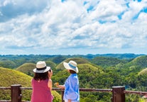
The mountain is part of Mt. Pulag National Park, which boasts mossy forests, grasslands, and rich biodiversity, including rare flora and fauna found only in the Cordillera region. Whether you're an experienced trekker or a first-time hiker, conquering Mt. Pulag offers an unforgettable experience.

How to Get There

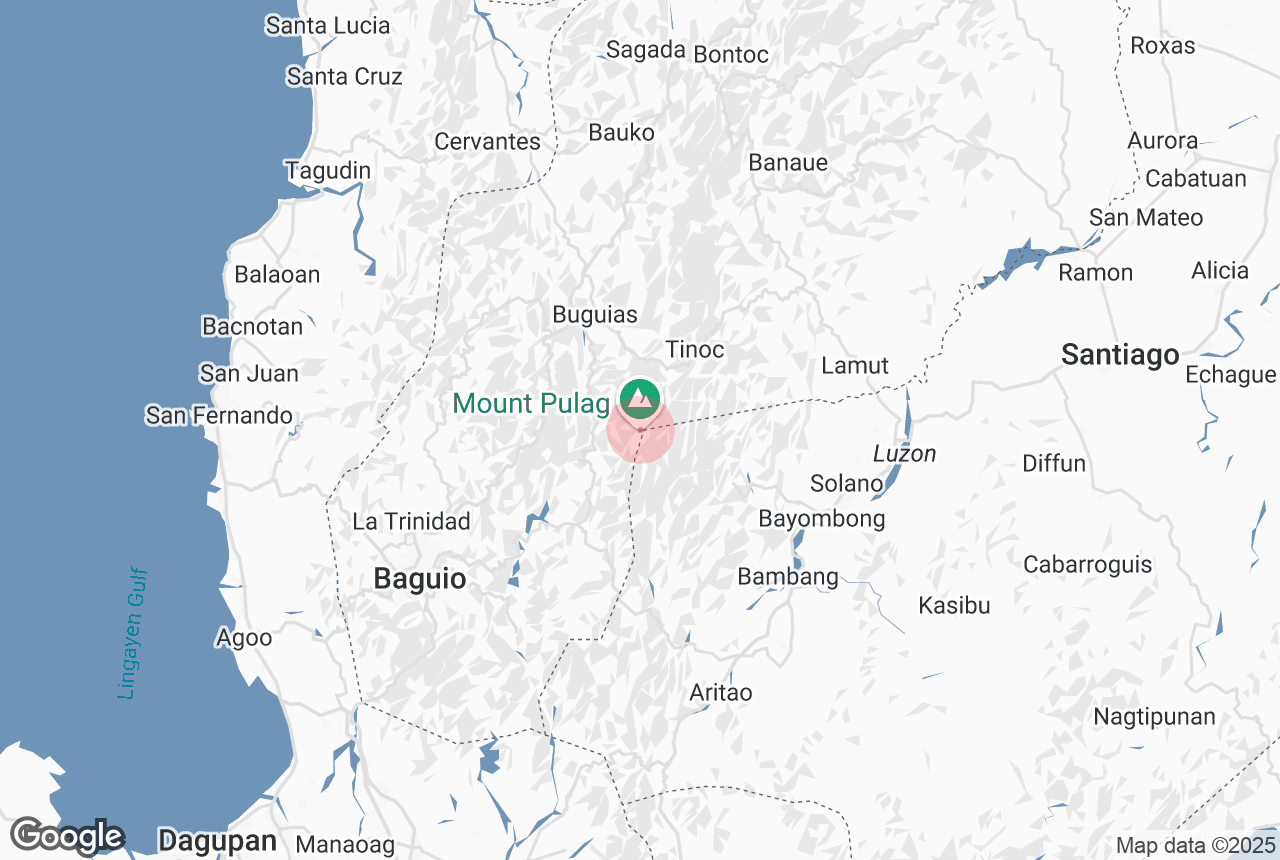
Mt. Pulag is located in the Cordillera Administrative Region, with trailheads accessible from Benguet province. The most common route is through Baguio City, which serves as the gateway for hikers.

From Baguio City, travelers take a 4- to 5-hour jeepney or van ride to the jump-off points in Kabayan town of Benguet Province, where registration and orientation at the Mt. Pulag National Park office are required before starting the trek.

For a hassle-free trip, you can book a guided Mt. Pulag tours, which includes transportation from Manila or Baguio Cities, permits, meals, and camping arrangements.

Hiking Trails and Difficulty Levels

There are multiple trails leading to the summit, catering to different skill levels:

Ambangeg Trail (Easiest, Ideal for Beginners) – This is the most popular and beginner-friendly route, often called the "executive trail." A Mt. Pulag Ambangeg trail hiking trip offers a gradual ascent through pine forests and grasslands, making it the best option for those new to high-altitude hiking.

Akiki Trail (Challenging, For Experienced Hikers) – Also known as the "killer trail," this route is steeper and longer, featuring dense forests, steep ascents, and river crossings.

Tawangan Trail (Remote and Wild) – A lesser-used but rewarding path, known for its rich biodiversity and cultural sites along the way.

Ambaguio Trail (Longest and Most Difficult) – The most demanding route, requiring multiple days of trekking from Nueva Vizcaya to the summit.

Best Time to Visit

The best time to hike Mt. Pulag is during the dry season from November to March, when the trails are less muddy, and the sky is clearer for viewing the famous sea of clouds. 

Temperatures at the summit can drop to freezing, so hikers should be prepared for extreme cold, especially from December to February.

It is recommended to book your hiking tours in advance, as the national park limits the number of hikers per day to protect the environment.


Frequently asked questions

Why is Mt. Pulag famous?

Mt. Pulag is known for its sea of clouds, where hikers can witness breathtaking views of rolling clouds from the summit at sunrise. It is also the highest mountain in Luzon and home to diverse plant and animal species.

How long does it take to hike to the summit?

The hiking duration depends on the chosen trail. The Ambangeg Trail (easiest) takes around 4-5 hours, while the more difficult Akiki Trail can take 10-12 hours or more.

Do I need a guide or permit to hike Mt. Pulag?

Yes, all hikers must register at the Mt. Pulag National Park office and attend a mandatory orientation. A guide is required for safety, and permits should be secured in advance.

What should I bring for the hike?

Essentials include a waterproof jacket, thermal clothing, gloves, a headlamp, trekking poles, and a sleeping bag for those camping overnight. The summit is extremely cold, so proper gear is necessary. Learn more in this guide to hiking in the Philippines.

Can beginners hike Mt. Pulag?

Yes, beginners can take the Ambangeg Trail, which is the easiest and most manageable route. However, hikers should still be physically prepared for the altitude and cold weather.

Are there accommodations near Mt. Pulag?

Most hikers camp near the summit, but homestays and lodges are available near the ranger station for those who prefer not to camp.

Attractions Nearby

Our best tours

Link to appstore phone
Install the Philippines’ biggest travel app

Download the Philippines’ biggest travel marketplace to your phone to manage your entire trip in one place

Scan this QR code with your phone camera and press the link that appears to add the Philippines’ biggest travel marketplace into your pocket. Enter your phone number or email address to receive an SMS or email with the download link.